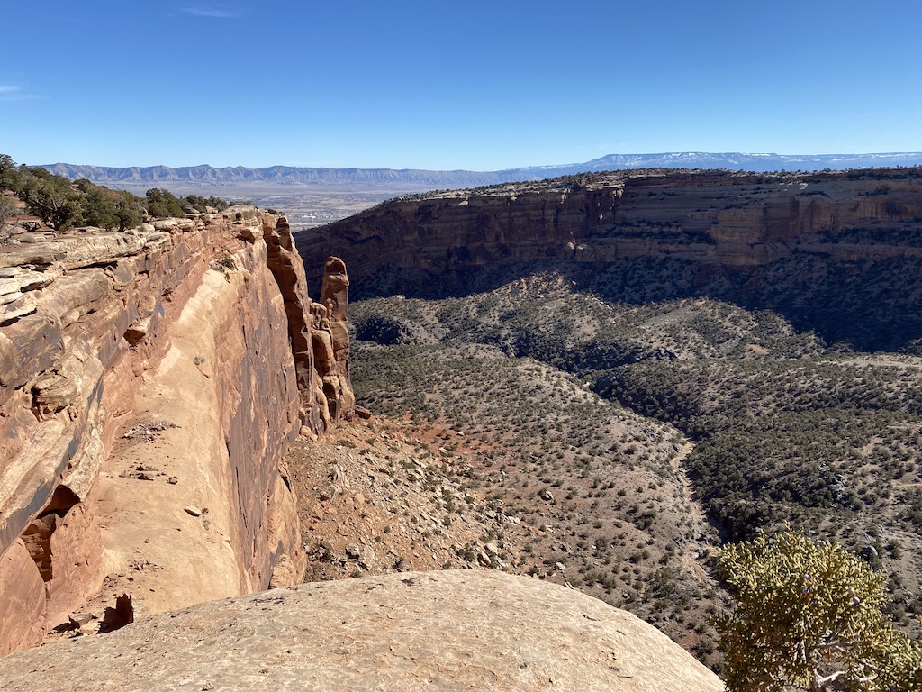
A few of winters ago, I wanted to do some simple camping and backpacking during winter to remain active and outdoors. One of my adventures was visiting the Colorado National Monument (CNM). The CNM usually remains snow-free with occasional snow. Temperatures still get cold. I hoped the out-of-season trip would not be crowded since the CNM is accessible from I70 outside Fruita, Colorado. The CNM is too tiny for backpacking, but several day hikes appeared worth doing. The CNM is closed to mountain bikes.
The Saddlehorn campground is open year-round, with the attractions being rock formations and dramatic views. (Unfortunately, I lost most photos I took.) The best time to visit the CNM is either in the late spring or fall, with wildflowers blooming and cottonwood trees changing. This trip allowed me to see the western slope of Colorado and checkout planning and navigation tools. Travel time from Boulder is 5 hours, so that I could do a short hike on the first day.
I planned to do the following hikes:
- Black Ridge Trail (12 miles)
- No Thoroughfare Canyon Trail (17 miles)
- Monument Canyon Trail (12 miles)

The CNM was as beautiful as described. The monument consists of dramatic canyons and rock formations shaped by weather and geology over millions of years. However, the canyons and rock formations are smaller in scale than the ones in the National Parks. The hikes were good; however, snow and mud made going sometimes tricky. I shortened all treks because of unexpected terrain. The No Thoroughfare trail is named well. After the first waterfall, I turned around because I needed to bushwhack the remaining 7 miles, even though GAIA showed a path. Because I cut the trail short, I had time, so I drove to the far end to backtrack, but the 6-8 inches of snow at that end turned me back. I was lucky to have decided to turn back because the snow would have made me return anyway. I did not bring micro-spikes, and snowshoes would have been overkill.
NOTE: I did not leave my gear out because of the proximity to I70 and Fruita. Instead, I packed it up before doing day hikes.
I met a man during the hike to the waterfall on the second day who thought a lost civilization created the rock formations around Fruita that the elite did not want us to know about. WACKY! He called as evidence that the debris and shear faces had to be created by machines. I countered that it could be made by wind and erosion over millions of years. He said that we are not as old as our leaders want us to think, saying our civilization is only a couple hundred years old. He then said that people found door frames and other building components in San Francisco when excavating. I noted that the 1906 earthquake destroyed the city, and to rebuild, the debris was built upon, and these were the building materials found when digging. He disagreed with that. I said that there were photos. He said that the elite wants us to believe that. Conspiracy theories are way too easy to trust rather than doing some research and thinking. I did not strongly argue since there was no point.
The Saddlehorn Campground was comfortable. Tent sites were readily available. Each tent site was flat, but some were muddier than others. Selecting a level site with pea gravel is less dirty than clay dust/mud. The V-stakes would only go in about 2-3 inches, so I reinforced them using rocks. The V-stakes have always been a pain to drive into the ground in Colorado, and I need t see if shepherd hook stakes work better.
The proximity to I70 and railroad tracks make the Saddlehorn Campground noisy. The temperature was cold at night, and I needed to ensure I slept with my electronics and water to prevent problems in the morning. Suburbs and small ranches surround the CNM, so I never felt away from civilization. I would not recommend the CNM for camping.
A lesson learned is to research the routes, pay attention to the topography, and find more information about current conditions, like using satellite photos and snow estimates.
