I made this trip from January 19, 2021, to Friday, January 21, 2021. I drove from Boulder and hiked the Picket Wire trail seeing dinosaur footprints and traces of homesteads. The next day I headed to Vogal Canyon and did a short hike around that area before heading to Picture Canyon. I spent the night at Picture Canyon, and the next day I hiked around the area looking for pictographs before driving home. The Comanche National Grasslands is a vast area in southeastern Colorado, which usually is clear of snow but still gets below freezing and windy. The Grasslands occupy two disparate regions. The first is near La Junta, Colorado and the other is near Campo, Colorado, which is close to the border with Oklahoma. Both sites were easy to get to and had spotty cell coverage. The terrain is wide open plains with canyons that were not always visible.
Whithers Canyon Trailhead and the Picketwire Trail were the first stop. I planned to camp at the trailhead and do a day hike to see dinosaur tracks and abandoned homesteads. The dinosaur track location was easy to find from the well-marked trail. The only tricky part was descending from the trailhead to the Picketwire Trail a couple of hundred feet down because the path was ice covered. There is also the Whithers Trail, which circles the trailhead and provides access to a bouldering site. It does look out over the Picketwire Trail as it winds through the Purgatoire Canyon.
I started in 45-degree, calm, sunny skies. Eventually, the weather warmed to 60 degrees, and I peeled off my mid-layer.
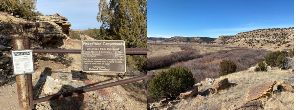
Several signs warned people of the harsh summer conditions at the trailhead. I cannot imagine people coming here in July with the 100-degree heat and exposure. The hike was level once descending from the trailhead. I kept a good pace of about three mph for the duration.
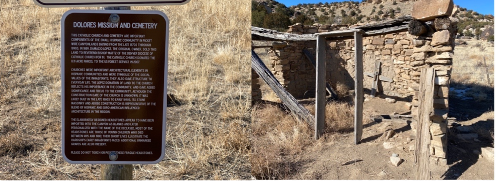
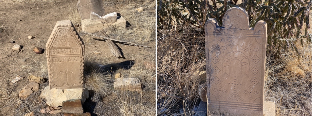
The Dolores Mission and Cemetery were fascinating. Homesteaders abandoned the mission in the early twentieth century for unknown reasons. However, the gravestones were elaborate. Sadly, the graves were of children who died in harsh conditions. The mission and cemetery were from the late 19th century. There was also a destroyed homestead and old telegraph wires strung between posts for part of the trail. Seeing the 19th-century way of communicating across long distances made me realize how vital and frail the telegraph system must have been. The builders and maintainers of the telegraph system must have had to endure hardships and continuous outages. Still, the alternatives were the mail system carried by whoever was going that way.
Hiking for a few more miles brought me to the dinosaur tracks site, where I had lunch and explored the area.
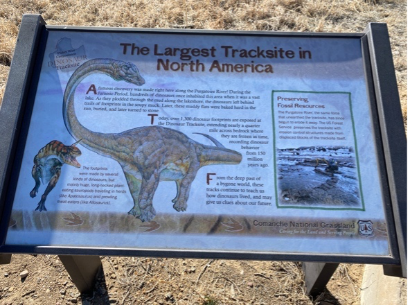
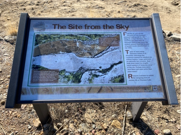
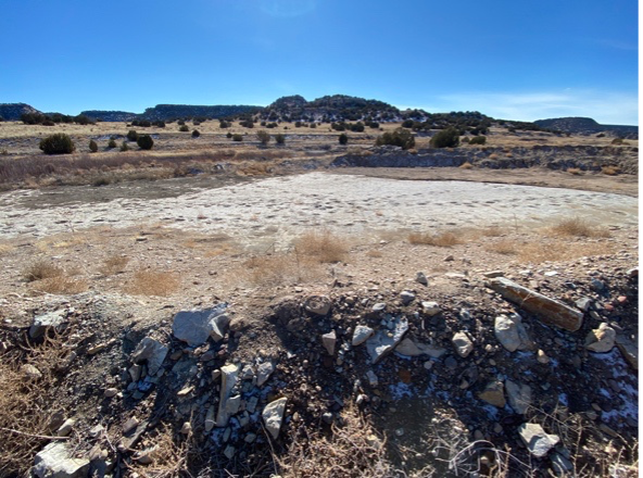
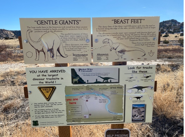
The dinosaur track site is the largest in North America, extending over a quarter mile. The US Forrest Service and archeologists from various organizations have done a great job preserving the site. According to studies, the tracks are estimated to be almost 150 million years old.
The Rourke Ranch is a short hike from the track site, which I did not do. The Rourke family abandoned the ranch in the 1940s and donated the land to the Department of the Interior. I returned to camp with plenty of time to pick a level site and set up my tent. There was an RV at the trailhead, but I never saw the occupants. A couple was doing some bouldering, and we waved greetings but never talked. I made some hot tea and backcountry chili for dinner. Once the sun went down, the temperature got cold into the mid-twenties.
When I woke from a frigid night, I walked around the Withers Canyon Trail after having a coffee and hot oatmeal. It was a short 500 m trail that looked out on the Purgatoire River and the Picket Canyon Trail.
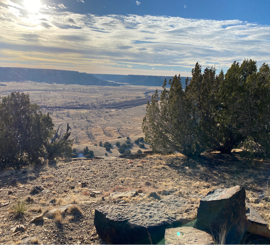
Some trivia – The river is named the Purgatoire because when the Spanish came to this area in the 17th century looking for the golden city of El Dorado, two soldiers died from a Native American attack. Since priests could not lay these soldiers to rest, they would spend eternity in purgatory. French trappers named the river Purgatoire. The river is also known as the Picketwire River. Movies (The Man Who Shot Liberty Valance, True Grit, and the Netflix western, Godless) reference the river.
I packed up and headed to Vogal Canyon, which was a disappointment. The canyon is about 15 miles from Whithers and near La Junta. The highlight for me was seeing pictographs by the Native Americans from between 300 and 800 years ago. This day would be easy with perhaps 3 miles of hiking. I was going to spend the night here. I quickly found the rock art and saw how defaced they were with modern graffiti, the oldest from 1927, according to the signature. This area would become part of the dust bowl in the 1930s, and miscreants had defaced what was really of value. There are plenty of abandoned homesteads on the USFS lands from the dust bowl of the Great Depression.
I decided to head to Picture Canyon instead of spending the night at Vogal Canyon (I didn’t even take pictures since I was disappointed by the defacement). The drive was about 3 hours, and I listened to some music and the euphoria of Biden’s inauguration. I was still looking forward to Picture Canyon and its pictographs because there are supposed to be more pictographs, and since it is more remote, assholes might not have defaced them to the extent the ones at Vogal were.
Southeastern Colorado is the high plains. It is primarily flat, and running water has carved canyons, so they are below the landscape. It is hard to imagine anything like a canyon on the landscape since the land is flat with grasslands and farms. Picture Canyon is 20 miles from a paved road, and I got to the site along a well-maintained dirt road through farmland. Cell coverage is spotty. The dirt road came up to a farmhouse and slightly descended into the canyon. The canyon had walls about 100 feet high. There is a picnic area with vault toilets and five covered picnic tables. No one was around, so I chose a camp spot and set up my tent.
I did not expect the weather to get windy and the temperature would get into the upper twenties. Even so, the canyon walls should protect me from extreme wind. I was looking forward to finding the pictographs the next day. They are supposed to be more extensive and include Native American calendars from the 18th century.
I slept well and got up early. I treated myself to two cups of coffee. My InReach was dead since I had left the message composition screen open and did not protect the battery from the cold during the night. When I opened GAIA GPS to check the hiking trails, the map was not on my phone, even though I had defined a route on GAIA GPS. I was using the free version, which does not download the maps. I got dressed and drove 5 miles until I got cell service and loaded the map in GAIA GPS. I also charged the InReach.
Three trails from the Picture Canyon TH are extensions of each other. The Arch Trail is about 4.5 miles in total, Homestead Trail is about 7.5 miles, and the Outlaw Trail is about 13.5 miles. I wanted to see the pictographs and enjoy the terrain, so I was going to play it by ear and prepare for a 13.5-mile hike. The Arch Trail led to a prominent rock arch. The Homestead Trail had some ruins of abandoned homes from the dust bowl. The Outlaw Trail looked like it was flat, judging from the contours. There were several canyons, including Picture Canyon, that could have pictographs. Picture Canyon is probably the one with the most since it is named Picture Canyon (duh) and is the largest canyon in this area.
I packed up and was ready to hike when a car drove up with an older couple who wanted to see the rock arch. They had a map printed from a brochure and were unsure how to navigate. I showed them how they could use their smartphones for navigating. They thought they needed cell service for GPS, but the GPS on the smartphone does not require cell service. I let them go ahead of me since I was going to take side trails to the canyon faces to see what I could find. I expected I would see them again.
I found petroglyphs close to the picnic area. There was significant defacement but not as bad as Vogal Canyon. The USFS has motion-sensitive surveillance cameras like those used for counting wildlife. However, nothing will happen unless a ranger catches the vandals in the act with camera footage that shows the vandal defacing the site.
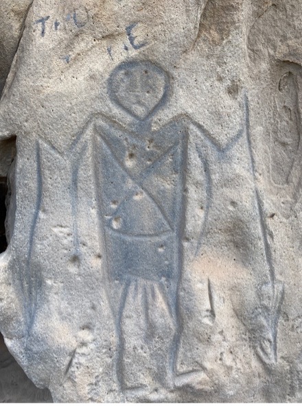
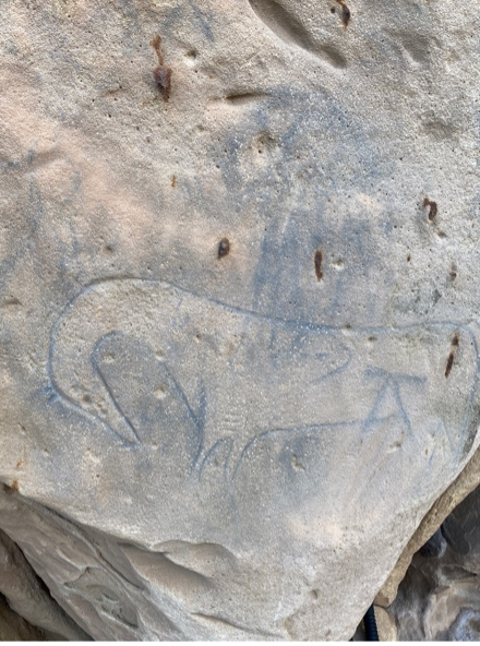
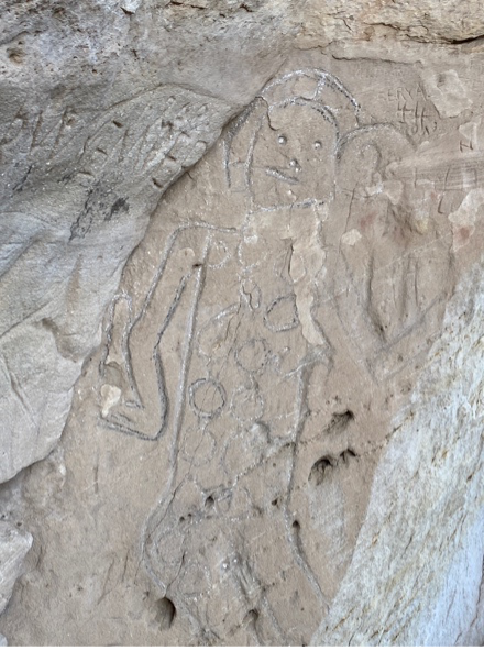
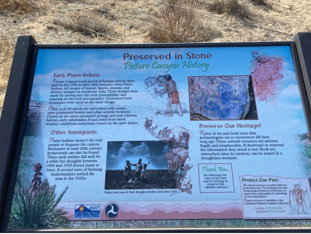
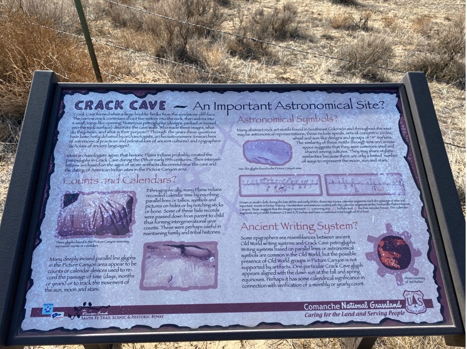
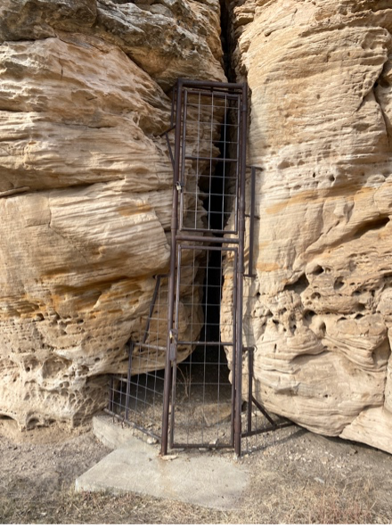
I returned to the through trail and found a destroyed old homestead from the 19th century near the Crack Cave, which authorities sealed off.
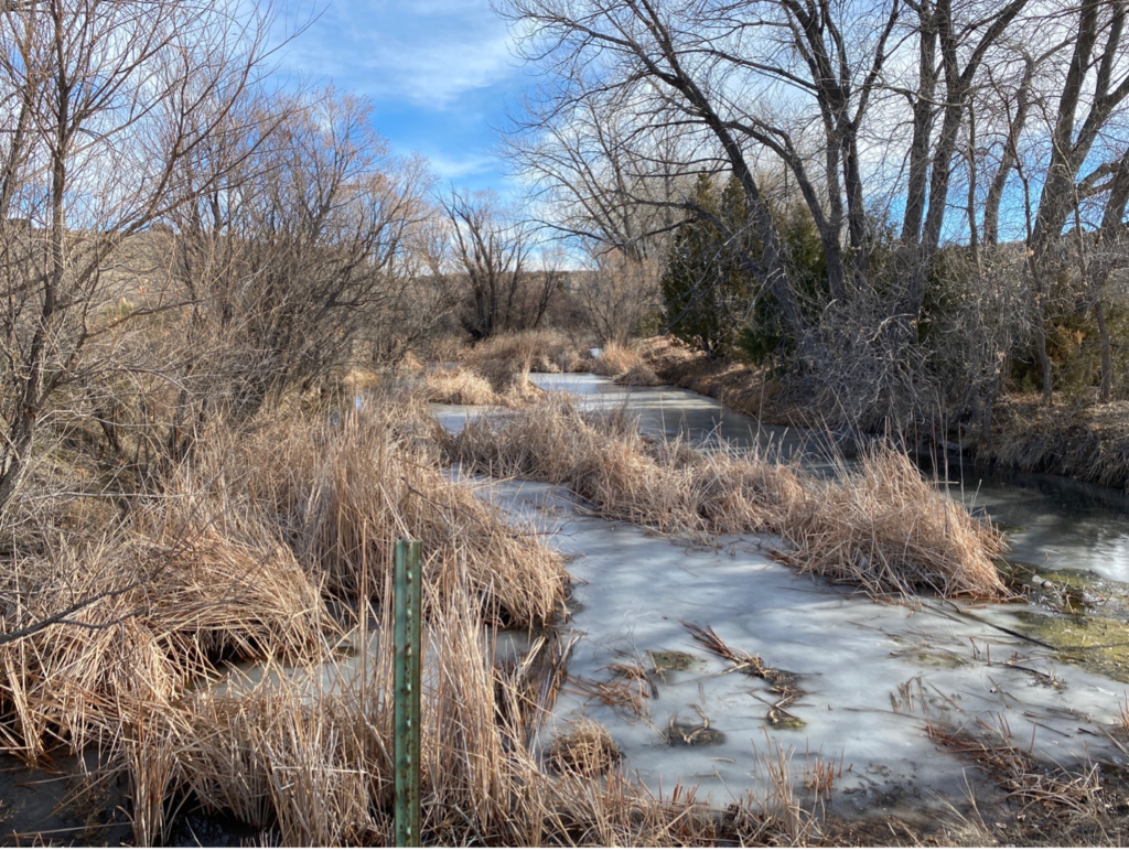
About a ½ mile after the Crack Cave, the trail split into a “Footpath” and a “Horse Path.” I took the footpath, which appeared to go through a canyon. I was hoping that the gorge might have more pictographs. GAIA GPS Topo maps and USFS maps only show the horse path, but it would be hard to get lost, so I went on the footpath. I ran into the older couple again. They were returning and said that a boulder had blocked the trail. I said I’d like to continue to see if there was an alternative. They said they did not see one but were friendly, saying I should try. I suggested returning to the horse path since it may be more accessible, thinking horses need a wider track and footing. So, they returned to the horse path.
I explored the footpath and saw the rock, which I went around. The path was unclear, and I saw other footprints, but I understood why the couple turned back. I went farther but decided to turn back when it became clear there were no chances of more rock art. I saw from GAIA GPS that my current track would likely intersect the established route, but bushwhacking would destroy the natural state. I had time, and the weather was good, so backtracking was my choice.
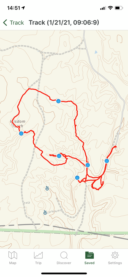
I never found the couple again, who probably turned back to the trailhead because the paths were unclear. I also accidentally got off the trail several times because the course was not marked well, and I wanted to explore side trails and find other rock art. The above track shows the footpath detour and some of my wandering. I always knew where I needed to go and strived to get back on the route to reduce my impact. In the below video, you can sometimes hear over the wind my comments that the trail is not evident, nor can I see another trail marker or cairns.
I never found more rock art. After returning home, I researched petroglyphs and pictographs and found that Canyonlands National Park and surrounding areas have the most extensive examples; however, assholes have vandalized most of these too. I need to take a trip to Canyonlands National Park and Horseshoe Canyon.
I headed back and ended up hiking over 6 miles. The hike was relatively flat, and the weather was good. I could have done more hiking, but the Outlaw and Homestead trails would not show additional petroglyphs or rock art. Rangers designed the courses for horses, so I decided to head home to a shower and my bed. I could get back to Boulder by 7 PM. Spending the night and returning the next day would not accomplish much.
Summary
I saw dinosaur tracks and Native American rock art. I realized how much vandals deface accessible petroglyphs. Over time, they only would get vandalized more, so I am glad I saw them.
I pushed both my equipment and mental toughness. I slept in cold, windy weather and learned lessons about clothing and keeping warm. Even on cold, windy nights, pee when needed. That action is hard but helps me relax so I can fall asleep.
